News and Petitions
What the association is currently campaigning for and news about our activities and events.
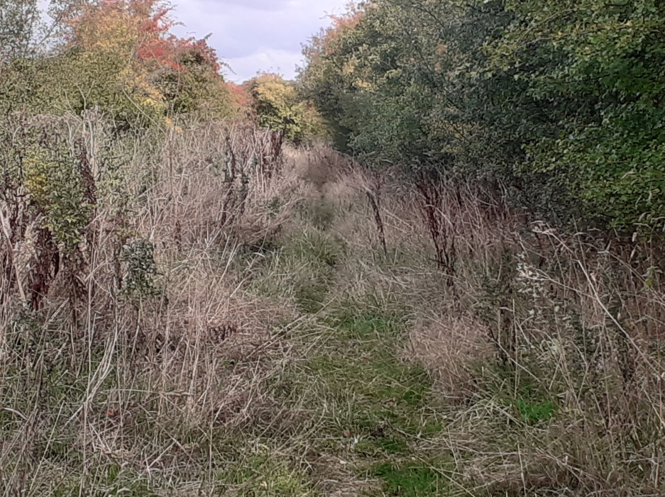
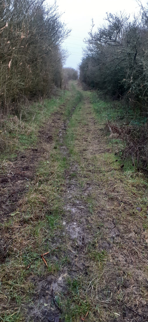
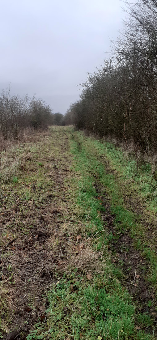
Application to upgrade bridleway Calne Without 89 (CALW89) to a restricted byway (ref: D/2022/020)
Wildlife and Countryside Act 1981 modifying the Definitive Map and Statement for the area by:
a) Upgrading to Restricted Byway the bridleway CALW89 which runs from Point A on the application map (OSGR SU 02531 68925), at the junction between the public highway at Theobalds Green, in the Parish of Calne Without and proceeds along the bridleway CALW89 in a southerly direction along the lane to Point C (OSGR SU 02396 68471) at the junction between the bridleway and the public highway in the Village of Calstone Wellington. With a width of: approximately 7m and shown on the map accompanying this application.
Copies of the following documentary evidence in support of this application, namely extracts of:
i. Andrew and Drury’s Map of Wiltshire (1773)
ii. Ordnance Survey 1st Edition Map (1805)
iii. Inclosure Plan for Calne, Calsone Wellington and Compton Bassett (1818)
iv. Map of the parish of Calstone Wellington (1830)
v. Tithe map of Calstone Wellington (parish), Wiltshire (1844)
vi. Ordnance Survey 25” County Series Map Sheet Wiltshire XXVII.10 (1886)
vii. Ordnance Survey 6” County Series Map Sheet Wiltshire XXVII (1889)
viii. Ordnance Survey 1” Map Sheet 266 & 157 (1889 & 1947)
ix. Map prepared in connection with the Finance (1909-10) Act 1910
x. Bartholomew’s Half-Inch Maps of England and Wales (1902 & 1942)
xi. Map produced from HM Land Registry INSPIRE database (2022)
The above-named application has now been determined by Wiltshire Council. The application has been refused in full.
The full officers decision report explaining the decision, its appendices and other documents can be viewed on Wiltshire Councils website at the following link. D/2022/020 - Rights Of Way - Wiltshire Council.
The applicant has a right to appeal the refusal of their application to the Secretary of State under schedule 14 to the Wildlife and Countryside Act 1981 within 28 days of the date of the decision letter from the authority , 19th June 2024.
Planning Application involving two Bridleways and two Public Footpaths around the Potterne Park, Wiltshire.
Wiltshire Bridleways Association has writen to express its concerns, ask for clarify and object to the proposed solar farm project at Potterne Park Farm.
To have you say, please comment using this link:
Planning Application: PL/2023/10332 (wiltshire.gov.uk)
Wiltshire Bridleways Association has writen to express its concerns, ask for clarify and object to the proposed solar farm project at Potterne Park Farm.
To have you say, please comment using this link:
Planning Application: PL/2023/10332 (wiltshire.gov.uk)
| wba_pl_2023_10332_object.pdf |
Parish of Ramsbury Path nos. 5,6 and 8C and Parish of Little Bedwyn path no.20 Diversion and Definitive Map and Statement Modification Order 2024.
|
The diversion order affecting paths Ramsbury 5,6,8C and Little Bedwyn 20 will be considered by the Eastern Area Planning Committee at its scheduled meeting on 13th June 2024 at 15:00 to be held in the Wessex Room, The Corn Exchange, Market Place, Devizes, SN10 1HS.
If you would like to address the committee or submit any further documents for the committee to consider please contact Matthew Hitch, Democratic services officer, using [email protected]. ( please note this email address was incorrectly transcribed in the previous emails regarding the committee meeting). The agenda and reports for the meeting will be published tomorrow on Wiltshire Councils website and can be found using the following link . Meeting - Democratic Services - Wiltshire Council |

|
Public rights of way at Giant’s Grave, Pewsey Wiltshire
|
We are looking for user evidence for the cul-de-sac bridleway leading towards Giant’s Grave, Rainscombe.
Horse riders and cyclists face frustrations in this area as although there are a good number of bridleways, it is impossible to link those south of Giant’s Grave with those to the north due to the status of routes being footpaths currently. The footpaths which are aligned North-South and dovetail into the bridleway are PEWS23 are SAVE30 & 32, plus PEWS61 & 68. The original def. map (1952) showed footpaths and a bridleway in this area in the same way as they are recorded now. However, during the Second and Special Review held in 1972 Wiltshire County Council proposed to downgrade the bridleway section of PEWS23 to a footpath. This was objected to and eventually, the matter was considered at a public inquiry with the Inspector deciding that it should stay as it is. So, sort of a victory! Please see attached for the Inspector’s report. If you have any recollection of using these footpaths on a bike or with hooves, please report this to us directly so we can provide your evidence to support higher rights. Please include approximate dates of use, type of use, and regularity of use for example from July 1995 to Oct 2023 at least twenty times each year on a bike. If you have tracking records such as Strava or Equilab, those will be very helpful. |

| ||
Works in Progress.
May 2023
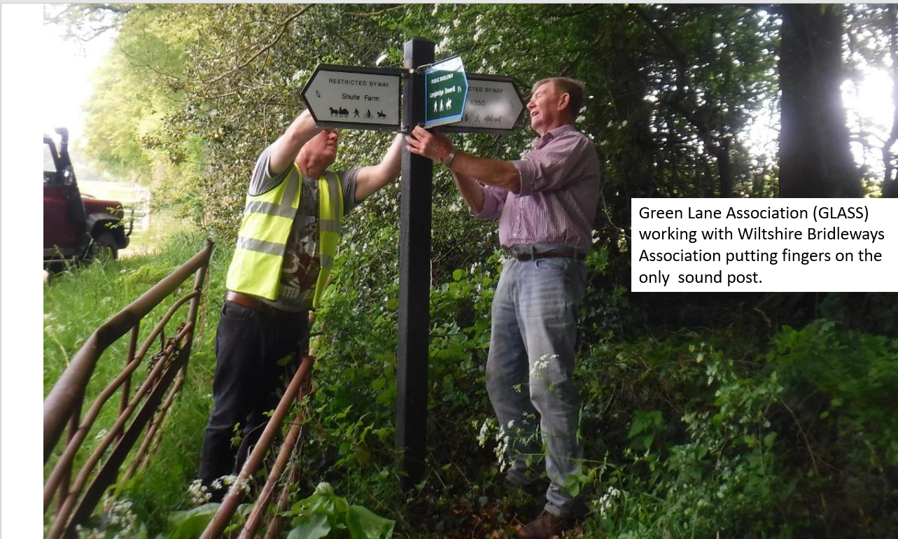
Working with Longleat Estate, Wiltshire Council Rights of Way & Countryside Team, Warminster Area Board, the Green Lane Association (GLASS), the Wiltshire Bridleway Association (WBA) and the Ramblers, the Salisbury Plain Rights of Way Volunteers (SPROWV) are helping improve the rights of way network on and adjacent to the Longleat Estate.
In 2022, two bridleways between Warminster & Corsley were linked with destination signs.
Sandy Lane, which links Warminster & Sutton Veny to Longbridge Deverill (Bridleways LDEV2, SVEN2 & SVEN3) was also signed.
Bridleway HORN4 benefitted from new signs too.
In a jointly funded project, destination signs are being installed on a number of rights of way (RoW) in Corsley, Longbridge Deverill & Horningsham over the next 2 years.
RoW with “higher rights” are taking priority but footpath problems near those bridleways & restricted byways are also being looked at.
As a continuation of the Sandy Lane project, SPROWV worked with the Ramblers Heavy Gang to clear a 160m length of overgrown bridleway SVEN2 to give a wet weather alternative to SVEN3 which becomes very muddy when wet.
Many thanks to the volunteers who worked with Nigel Linge to enable all the improvements.
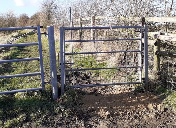
Some recent improvements undertaken by Wiltshire Council following Wiltshire Bridleways Association applying pressure.
Charlton St Peter Bridleway No. 1 Renovations by
Wiltshire Council following the perseverance by WBA committee members.
Wiltshire Council following the perseverance by WBA committee members.
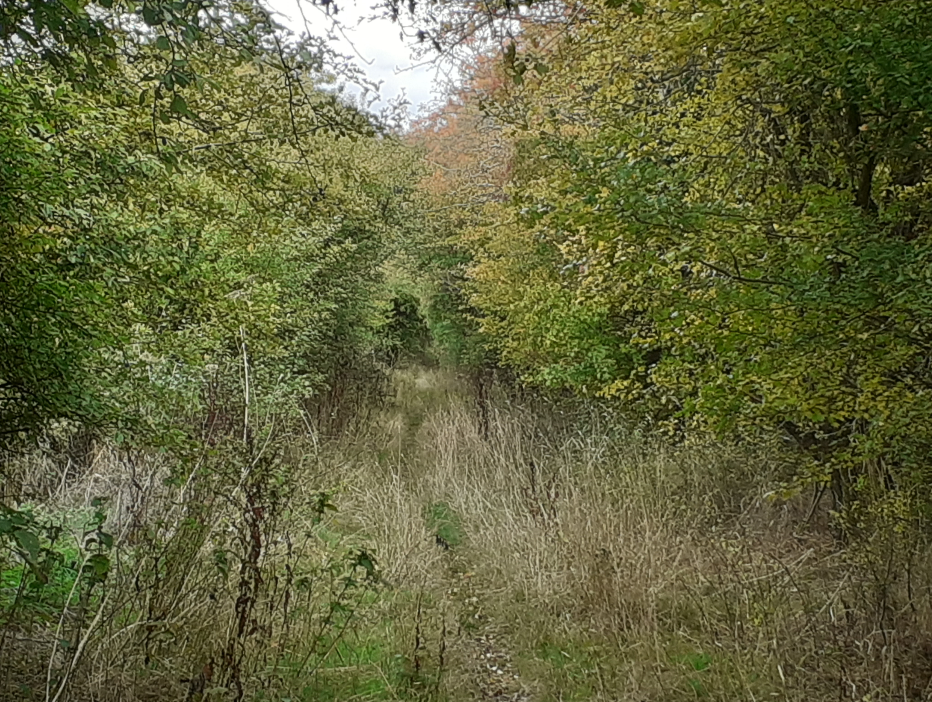
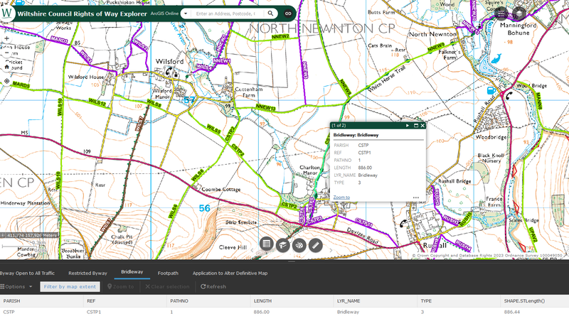

Wilsford Bridleway WILS8 Gate Improvements
New Signage for Etchilhampton
New Signage for Etchilhampton
Wilsford
Bridleway
WISL8
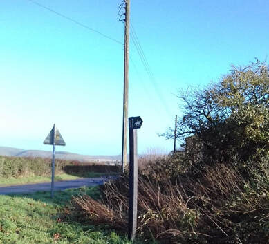
Etchilhampton
Bridleway
ETCH8
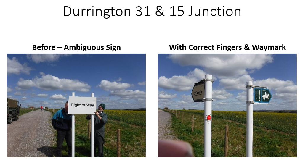
Sharing Great Work by another Local Team who cares greatly about preserving and protecting our rights of way.
The Salisbury Plain Rights of Way (AWESOME) Volunteers completed a signing day in early April. They resolved 15 issues, a proportion that they came across, heading to the next known problem.
They are still developing a plan for permanent Voluntary Restraint signs (until a route is repaired). The Green Lane Association has agreed to pay for the signs. The plan is to seek funding from Area Boards for the posts, postcrete and fixings, but as this spans 8 x Area Boards, Nigel Linge, who heads op the team, is still working on how to do that.
Wiltshire Council has about 4,000 unresolved Right of Way reports. So the work undertaken by the Salisbury Plain RoW Volunteers for repairing/replacing some fallen/damaged/missing RoW signs in more remote areas is a very effective solution that you could support and utilise.
Did you know that by changing the signs to destination signs, parish councils can apply for Area Board grants to get the materials provided to fix issues and, therefore, greatly reduce the costs?
The Salisbury Plain RoW Volunteers generally get out about once a month and are now fairly well on top of the Plain remedial works. They hope to do some work in the Warminster area during the summer, so if you wish to help, please get in touch, and The Wiltshire Bridleways Association will connect you.
CHAIRMAN'S REPORT FOR WBA AGM
ON THU 31 MARCH 2022
At our AGM on 21 March 2019, I commented that the committee had grown with the addition of two new members. Unfortunately,
in 2021 we shrank by two. Firstly Vicci Palmer moved to Devon. Secondly, Vicki Thomas, our Minutes Secretary Vicki Thomas stood down. We pass on our best wishes for the future to them both.
Through our newsletter, we advertised for a replacement secretary. Fortunately, Barbara Macmullen, our previous secretary with some 17 years in the post, volunteered to step back into the chair on a 'TEMPORARY', and I stress the word 'TEMPORARY' basis. I am most grateful to Barbara – Thank you.
The position of Minutes Secretary is still open. So please give this some serious thought and volunteer.
In 2019 the committee continued with their role of attending meetings with other agencies, Wiltshire and Swindon Community Access Forum, Wiltshire Council PROW Department, DIO (MOD), to name but three, travelling around the county to assess reported problems and submit relevant documentation to WC. We continued to examine and comment on applications for DMMO's, planning applications which affected PROW's etc.
As we approached March 2020, the bubble burst and COVID grounded us. A planned formal opening of the newly completed Imber Range Perimeter Path, a project in which WBA had been involved from the beginning, was postponed and subsequently cancelled, as was our own AGM for that same month.
Monthly meetings for the period March to August inclusive, plus November and December 2020 were also cancelled. We did manage to hold meetings in September and October, but these were strictly limited to six attendees. 2021 continued in the same vein, with five meetings only, from August to December inclusive.
Correspondence from WC and other organisations also dropped dramatically, and volunteer clearance groups were forbidden to operate.
However, people were still out for their one-hour permitted exercise and did send in reports, e.g., padlocked gates, even one where the gate had been nailed shut, plus the usual vegetation growth and fallen trees.
Recently I have heard whispers of more landowners denying the existence of PROW's across their land. These have still to be investigated. As for the reporting problems, please continue to do so to Wilts Council via the 'MyWilts' app and to WBA via our website. We may have additional information about your route, which could help further. Please don't turn a blind eye and leave it for someone else. Also, once reported, keep checking progress and any notes WC may have added. Some simply say, 'In Progress', and there they stay. Others say, 'Dead end' so will be a low priority or 'will deal when time allows'.
Over the last four years, WBA has made several approaches to Wilts council to offer some financial assistance towards paying contractors to carry out maintenance work. Responses invariably have been muted, e.g. "It may create accounting problems. It must be used for maintenance issues only, not enforcement. Deal directly with the individual Countryside Access Officer."
None of these has taken us any further forward. The PROW team have recently been taken under the umbrella of Highways, and the challenge is being taken forward by Michelle Haley, who appears to be making some headway.
On the subject of outstanding work, on Tue, 8 March 22, I attended a virtual CAF meeting where we heard from WC that they currently have a backlog of 4913 PROW reports. During the last year, 1348 have been recorded as completed/closed. At the same meeting, we also heard that after much lobbying the The government have dropped the requirement for DMMO application to be submitted by the 2026 deadline. In that context, it was reported that WC currently have an outstanding list of 347 DMMO's awaiting action. At the current rate of progress, WC estimate these will take between 50 – 60 years to clear.
As you are aware, our only source of income is membership fees and revenue from pleasure rides. No rides were held during 2020. However, despite all the difficulties and much hair pulling by Rosie Pack, our annual ride in Savernake Forest did take place. This was rather smaller than in previous years as the Forestry Commission limited attendees to 50 riders maximum. To Rosie and all her Marshalls, thank you.
I hope you will join me in saying a big Thank You to all members of your committee for the number of voluntary hours they spend
devoted to your bridleways.
Norman Beardsley
Chairman
You could help us!
Become an Representative for your Area
There are many benefits of becoming a committee member or an Area Representative.
- Prioritisation of issue resolution in your area
- Fantastic, knowledgeable support from existing experienced committee members
- Inclusion in all WBA meetings and copies of meeting minutes, i.e. total awareness of all issues, connections with influential decision-makers
- Ability to offer your localised community support
- Be happy knowing that you are contributing to preserving bridleways in your local vicinity for everyone.
